Submitted by Jason Young
on
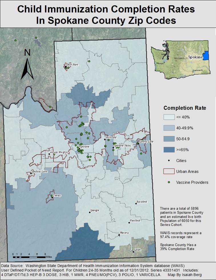
In Spring 2013 geography undergraduate students Devin Hacket, Zak Lee, and Isaiah Berg worked on a project called VaxViz in the department's GIS Workshop, GEOG 469, taught by Professor Nyerges. The client for this project was WithinReach. According to Isaiah Berg, their project works to help health practitioners make better use of Washington's Immunization Information System (WAIIS), a robust but underused database in the state. VaxViz itself is a tool-suite, comprised of Python scripts and a standard operating procedure to help local health practitioners map immunization data locally. With help from the Department of Health's Office of Immunization and Child Profile the project evaluated the accuracy, validity, and completeness of the WAIIAS. The students then developed a set of Python scripts and instructions to seamlessly transfer HTML 'Pocket of Need' data into a Geodatabase with ready-to-use layers. They believed that the research and theory-of-concept has the potential to empower local health jurisdictions with new analytics for immunization surveillance, monitoring, and evaluation.
Since completing the project, the team has had the opportunity to present their findings to the Washington State Secretary of Health, and their research and theory-of-concept have been presented to the Washington Immunization Action Coalition WIAC. Next month they have the opportunity to present their findings at the 11th National Conference on Immunization and Health Coalitions. Chris Halsell, the Immunization Assessment Coordinator at the State Department of Health, will be co-presenting these results.