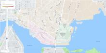
Students in Professor Sarah Elwood's Geography 258 course last quarter spent much of their time working toward creating a final portfolio of digital maps created throughout the quarter. Focusing on the use and societal impacts of contemporary digital spatial technologies, the course allowed Professor Elwood to provide the students with the creative opportunity to explore the components that go into creating and sharing digital maps.
One such example of this was a project that required students to create a virtual tour guide using Google Maps. Whether it was guiding map users around local coffee shops, hiking trails, or architectural landmarks, students were exposed to the intricacies that go into conveying map information in simple and effective ways using existing popular map applications like Google Maps.
Another project involved group mapping observations of public art. Students developed a survery using the a Web-based survey application Fulcrum and collected data on public art around Seattle (We are grateful to Fulcrum for educational access!!!). They used Carto, an online mapping platform, to visualize the data. Besides the unique exposure the students received by working with different data collection and map making platforms, they also were able to confront the biases that exist in map creation. What counted as public art for one group member versus the other highlights how map makers bring their preexisting biases to their work.
The experiences students had in Professor Elwood's course showcases how layered and complex digital mapping can be. Overall, the learning opportunity of working with some of these contemporary digital technologies and their societal impacts leaves students much more prepared should they plan to explore digital map making in the future.
You can check out their terrific work on the map gallery page: http://tinyurl.com/2017gallery.
