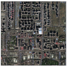
A fire in Central Park seems to appear as a smoke plume and a line of flames in a satellite image. Colorful lights on Diwali night in India, seen from space, seem to show widespread fireworks activity.
Both images exemplify what a new University of Washington-led study calls “location spoofing.” The photos — created by different people, for different purposes — are fake but look like genuine images of real places. And with the more sophisticated AI technologies available today, researchers warn that such “deepfake geography” could become a growing problem.
So, using satellite photos of three cities and drawing upon methods used to manipulate video and audio files, a team of researchers set out to identify new ways of detecting fake satellite photos, warn of the dangers of falsified geospatial data and call for a system of geographic fact-checking.
“This isn’t just Photoshopping things. It’s making data look uncannily realistic,” said Bo Zhao, assistant professor of geography at the UW and lead author of the study, which published April 21 in the journal Cartography and Geographic Information Science. “The techniques are already there. We’re just trying to expose the possibility of using the same techniques, and of the need to develop a coping strategy for it.”
